WSTS-2544 - Wireless Ship Tracking Systems
The Wireless Ship Tracking System WSTS-2544 is designed to track the location of a ship during signature measurements and ranging over Omnitech Electronics' degaussing measurement range. The range software requires the precise location of the ship on range. The ship’s internal navigation systems do not always have enough resolution or accessible formats and sharing position data with external systems is often prohibited by security requirements and regulations. The WSTS can be temporarily installed on ship quickly and provides measurement systems with accurate ship tracks and headings during ranging.
The WSTS uses two GNSS Receiver Units installed on the bow and stern of the ship under test. The units send position data over a radio link to a central base station. The base station shares and records the real-time, high-resolution, positions and sends this data to the range software which computes the ship’s electro-magnetic signature.
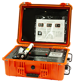
The WSTS-2544 consists of 2 or 3 GPS Receiver Units (GRU) and a Data Collection Unit (DRU). One GRU is installed on the bow and stern of the vessel and a third can be installed at a fixed base-station and used in position corrections such as RTK processing.
The GNSS Receivers support a comprehensive set of position correction methods and subscription services that improve position accuracy to better than 1 m.
System Functionality
Highlights
- Sub-meter accuracy
- Multiple radio frequencies available
- Real-time ship position display
- Battery powered operation
- Log GPS data to SD Card
- Retrieve data logged to SD Card via radio link
- Supports GrafNav or RTK post processing
- Supports L-Band corrections over radio link
The GNSS Receiver Units (GRUs) read, record, and transmit GNSS data. Each GRU has a removable SD card for local data storage that can be used to recover data when wireless data functions are disabled. The units can be powered from a removable/rechargeable battery or from an external AC source.
The GRU has an LCD screen that displays the current setting and operating information of the GPS and the radio transceiver unit. Buttons located to the right of the LCD display are used to navigate and control the menu/settings.
Shore Software
An optional shore software application will overlay the ship position on a GIS display, record position data and monitor the radio link integrity.
Radio Options
The modular design of the WSTS allows for a variety of radios for the RF data link. Whether low power ISM band radio or a high-power licensed band, Omnitech Electronics will ensure each system meets the consumer’s radio requirements